
New York City’s vertical architecture can feel overwhelming when experienced solely from street-level sidewalks or through rushed visits to multiple ticketed observation decks. A well-designed skyline day pairs the sweeping perspective of an elevated vantage point with grounded pedestrian exploration through the neighborhoods below. Rather than treating viewpoints as isolated photo stops, linking high-altitude observation with waterfront promenades and architectural walking corridors reveals the structural grid and geographic waterways that define the metropolis.
Creating an unhurried itinerary requires selecting a single primary vantage point that aligns with your specific aesthetic goals, allowing adequate buffer time for security screenings, and leaving space for transit pauses across the East River. By balancing one high-altitude platform with free public civic viewpoints, travelers experience the contrast between monumental urban scale and human-scale neighborhood life.
NYC Viewpoint Matrix: Comparing Observation Decks and Free Public Vistas
| Vantage Point | Elevation / Type | Primary Visual Orientation | Optimal Light Timing | Primary Advantage / Trade-off |
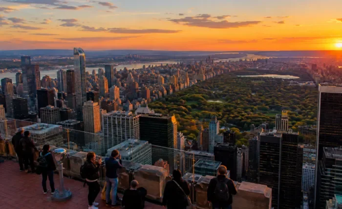
| Top of the Rock (Rockefeller Center) | $850\text{ ft}$ (Outdoor Deck) | Unobstructed north view of Central Park; direct south view of the Empire State Building | Golden Hour into Sunset | Open-air terraces without glass glare; high demand for sunset time slots |
| Summit One Vanderbilt | $1,000+\text{ ft}$ (Enclosed Glass) | Direct views of the Chrysler Building and Midtown East grid | Mid-Morning or Full Night | Immersive multi-sensory mirrored installations; high indoor glare for photography |
| Edge at Hudson Yards | $1,100\text{ ft}$ (Cantilevered Deck) | South and east toward Lower Manhattan and New Jersey skyline | Late Afternoon | Glass floor cutout and angled outdoor walls; wind exposure can be severe |
| One World Observatory | $1,268\text{ ft}$ (Enclosed 360°) | Panoramic harbor, Statue of Liberty, Brooklyn, and Manhattan bridges | Early Morning | Maximum regional elevation; fully enclosed behind double-paned interior glass |
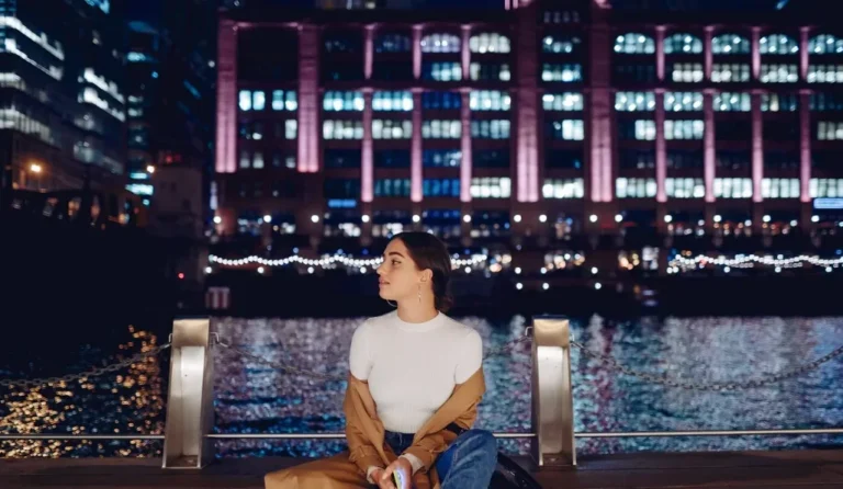
| Brooklyn Bridge Park (DUMBO / Pier 1) | Ground Level (Waterfront Esplanade) | East-to-west view across the East River toward Lower Manhattan financial towers | Blue Hour into Twilight | Free admission; spacious outdoor seating; ideal wide-angle architectural framing |
| Brooklyn Bridge Pedestrian Walkway | Elevated Promenade | Sweeping diagonal angles of Downtown Manhattan and Midtown spires | Sunrise or Early Morning | Free admission; historic gothic masonry arches; heavy pedestrian traffic by midday |
Architectural Orientation: Reading the Urban Grid
Viewing Manhattan from an elevated deck provides a spatial understanding of the city’s geological and urban development:
-
Bedrock Geology and Skyscraper Clusters: The concentration of supertall towers in Midtown and the Financial District directly reflects underlying Manhattan schist bedrock, which lies close to the surface in these zones and can support massive foundation footings. The lower-rise profile of Greenwich Village and SoHo corresponds to areas where bedrock drops substantially deeper below surface soil.
-
The Street Grid Framework: Established by the Commissioners’ Plan of 1811, Manhattan’s rectangular grid of numbered avenues running north-south and streets running east-west becomes legible from above, illustrating how Central Park anchors and interrupts the flow of Midtown traffic.
-
Waterway Boundaries: Elevated platforms highlight how the Hudson River to the west and the East River to the east funnel rail, bridge, and ferry traffic into the primary commercial cores, emphasizing the island geography that shaped New York’s growth.
Connecting Heights to Sidewalks: The Two-Borough Transit Corridor
Pairing an elevated Midtown platform with a Brooklyn waterfront descent provides a balanced full-day itinerary:
[ Morning: Midtown Architectural Walk ] ──► [ Midday: Elevated Observation Deck ]
 (Fifth Ave / Bryant Park / Grand Central)     (Top of the Rock or Summit)
                                                         │
                                        [ Subway Line: A/C or F Train to Brooklyn ]
                                                         │
                                                         ▼
[ Evening: DUMBO Waterfront & Pier 1 ] ◄─── [ Late Afternoon: Brooklyn Bridge Walk ]
 (Sunset reflections & skyline illumination)    (Traversing east-to-west or vice versa)
-
Midtown Architectural Baseline (Morning): Begin at street level around 42nd Street. Examine the Art Deco setbacks of the Chrysler Building, the Beaux-Arts facade of the New York Public Library Main Branch, and the shaded perimeter of Bryant Park. Walking these blocks first establishes the physical scale of the towers before viewing them from above.
-
Elevated Perspective (Midday / Early Afternoon): Ascend your chosen observation deck during off-peak midday or early afternoon hours. This avoids the dense ticket lines common at sunset while offering clean, clear overhead light for architectural study and long-distance views toward the harbor.
-
Transit Transition to Brooklyn: Take the downtown A/C train to High Street or the F train to York Street. Descend into Brooklyn Bridge Park and the historic cobblestone streets of DUMBO (Down Under the Manhattan Bridge Overpass).
-
Waterfront Twilight at Pier 1: Position yourself along the Brooklyn Heights Promenade or the granite ledges of Brooklyn Bridge Park as the sun drops behind Lower Manhattan. Watching the office towers shift from daylight silhouettes into illuminated geometric patterns across the East River provides a dramatic perspective without the crowds of an enclosed deck.
Logistical Preparation and Ticketing Strategy
Navigating premier vantage points requires planning around security lines and weather conditions:
-
Timed-Entry Reservation Buffers: Observation decks operate on strict timed-entry intervals. Arrive at least 30 to 45 minutes prior to your reserved slot to navigate airport-style metal detectors and multi-stage elevator transfers. Missing a designated window during peak periods can result in standby delays or denied entry.
-
Managing Weather and Atmospheric Visibility: Check hourly local cloud ceilings and wind speeds before purchasing non-refundable passes. Low stratus clouds can completely obscure views at elevations above 800 feet, leaving visitors trapped inside thick fog. Opt for clear days or days with high, broken cirrus clouds, which catch warm color during golden hour without obstructing ground visibility.
-
Comfort and Security Restrictions: Most high-altitude platforms prohibit tripods, large luggage, and professional commercial recording rigs. Travel light with a compact crossbody bag, carry a portable battery pack to manage cold-weather phone discharge on exposed outdoor decks, and bring a wind-resistant shell layer, as summit temperatures are typically 5 to 10 degrees colder than street level.
Skyline Photography Techniques
Capturing high-contrast cityscape scenes requires adapting camera settings to urban geometry:
-
Eliminating Window Reflections: If photographing from an enclosed deck (such as Summit One Vanderbilt or One World Observatory), place your smartphone or camera lens directly against the glass pane, or use a flexible silicone lens hood to block ambient interior lights from creating double exposures on the window.
-
Framing Scale with Foreground Geometry: Use the outdoor stone parapets, safety glass panels, or distant suspension bridge steel cables as foreground elements to provide depth and perspective against the sprawling field of background skyscrapers.
-
Exposing for Highlights During Twilight: During the transition from sunset to dusk, expose for the bright office windows and sky rather than lifting dark shadows. Underexposing slightly preserves the saturated orange and violet hues along the horizon and prevents the illuminated spire lights of the Empire State Building from blowing out into overexposed white patches.
An unhurried skyline itinerary relies on pairing high-altitude perspectives with relaxed sidewalk exploration. By selecting a single main observation deck, taking advantage of open civic parks along the East River, and allowing transit schedules to unfold without rushing, visitors experience the balance between New York City’s soaring architecture and its vibrant public spaces.